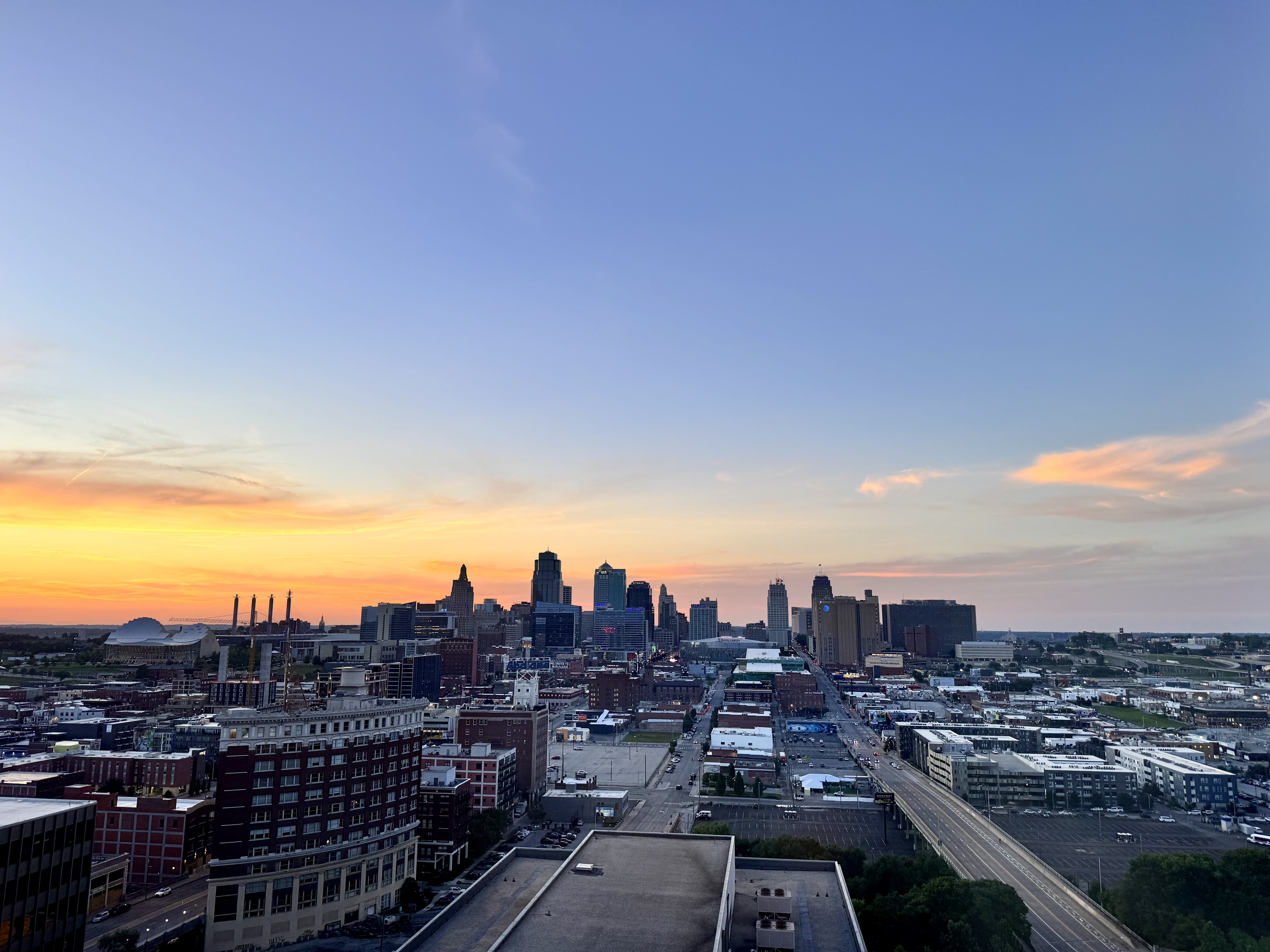
Gosh that’s flat. Are there hills out of shot, or is it all like that?
Edit: I guess the building you’re in is on at least a bit of a hill, and there’s some elevation in the distance on the left and right.
Gosh that’s flat. Are there hills out of shot, or is it all like that?
Edit: I guess the building you’re in is on at least a bit of a hill, and there’s some elevation in the distance on the left and right.
While here, I work at a convention center that is in the top left of the photo. If I walk there, it is a gentle uphill slope much of the way then one pretty sharp hill for a block or so. Overall though, yeah, this region is flat. They don’t call it the Great Plains for nothing.
She’s actually stood on @pillbox 's Roads and Boats collection
I love going to Crown Center. Lots of cool stuff right there in walking distance.
She’s near the confluence of the Kansas and Missouri rivers… one of the hilliest places in the area. It’s, generally, much flatter.
Last year we got the Museum of Bar B Q there to stay open late one night for our group. It was lots of fun!
Kansas, the next state west of her is flatter than a pancake. Literally— there’s a math journal article about it.
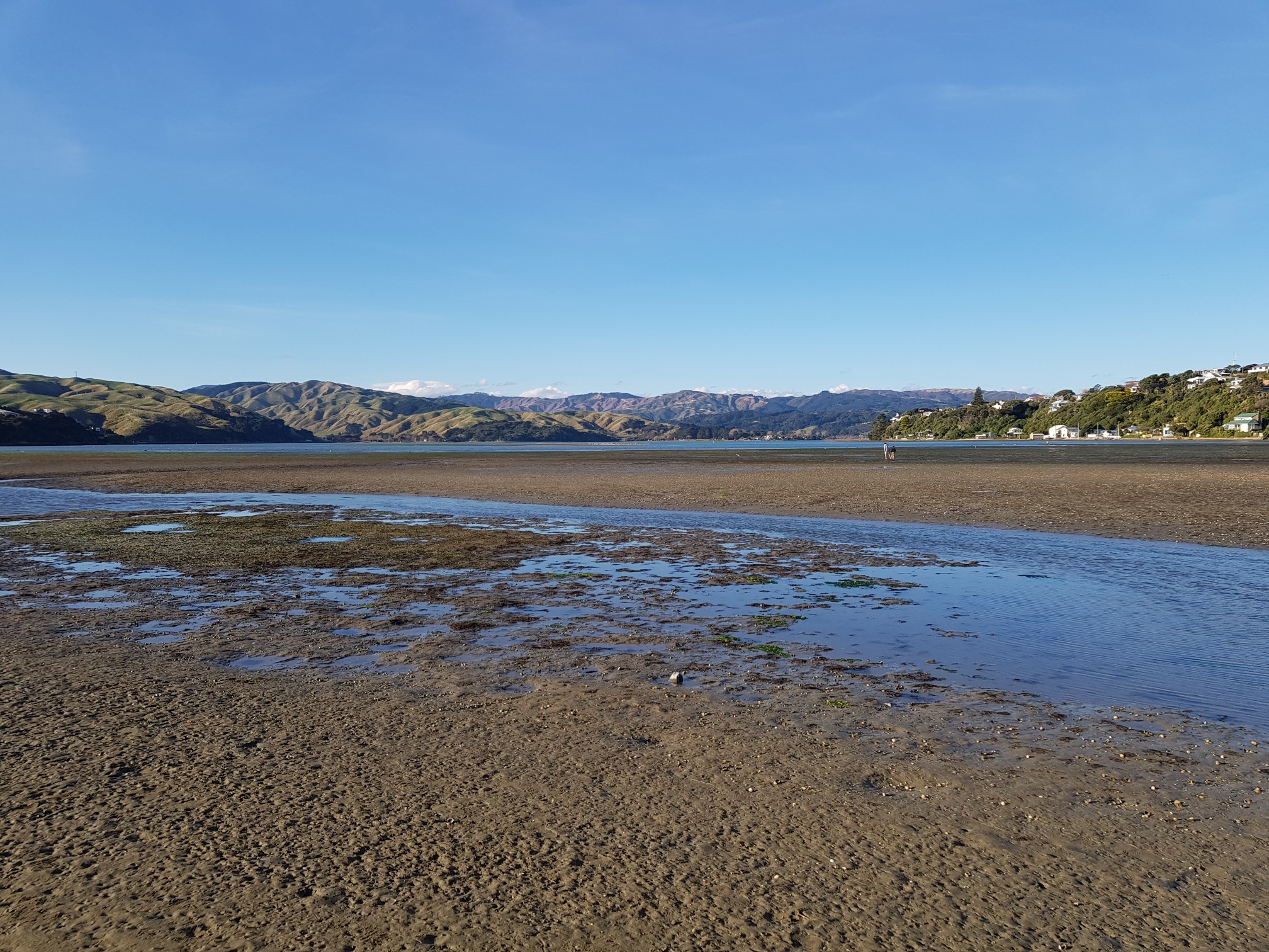
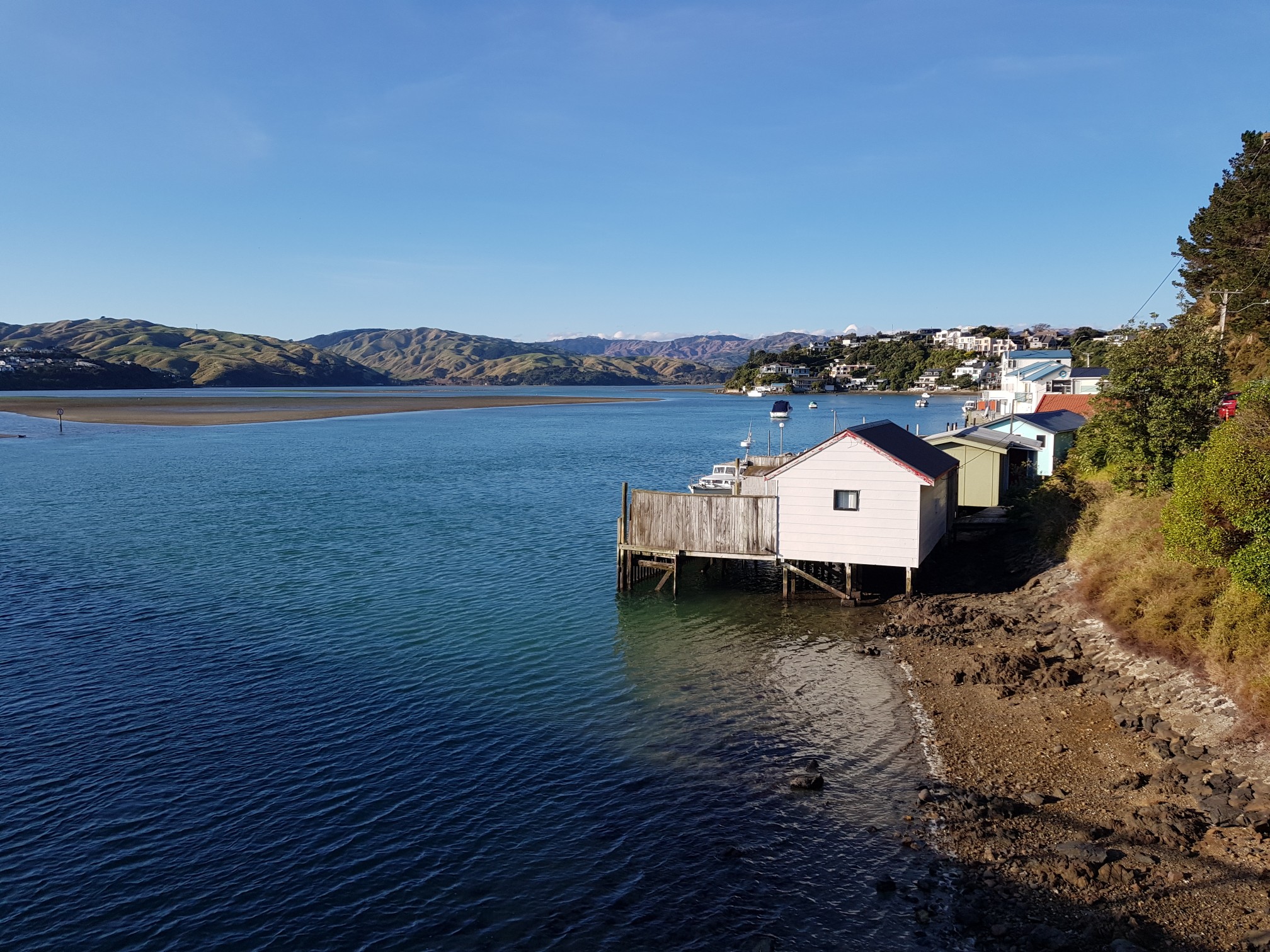
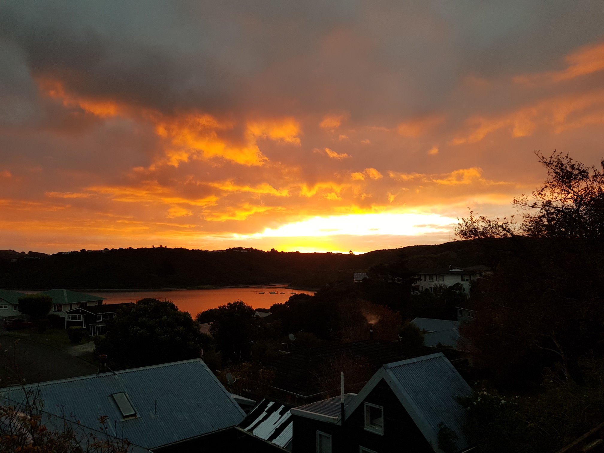
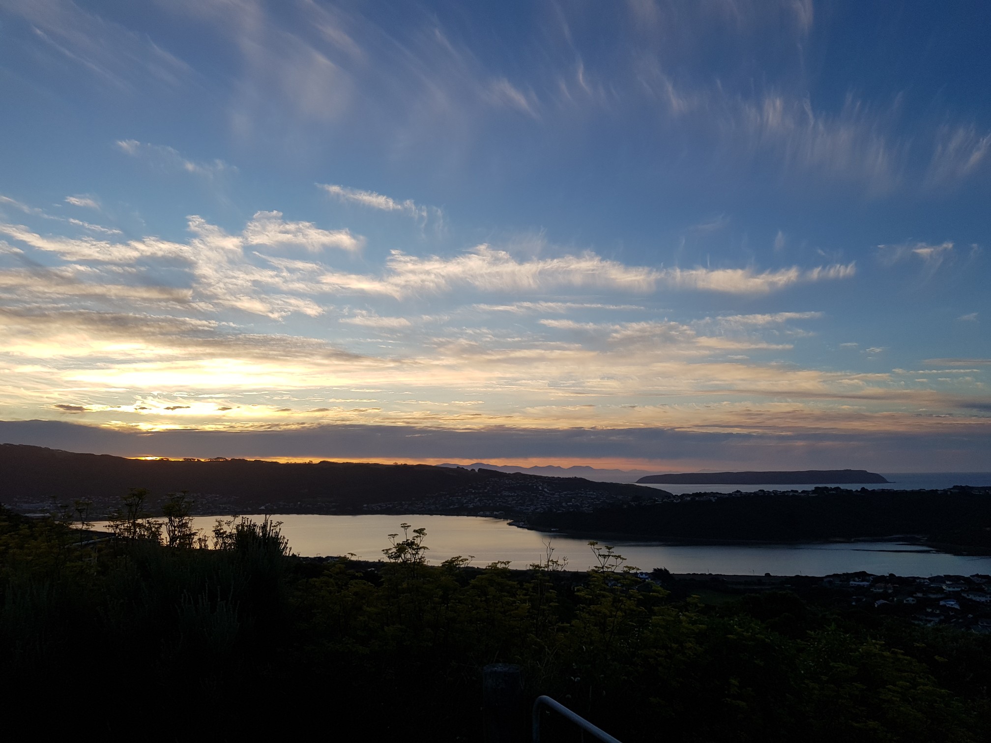
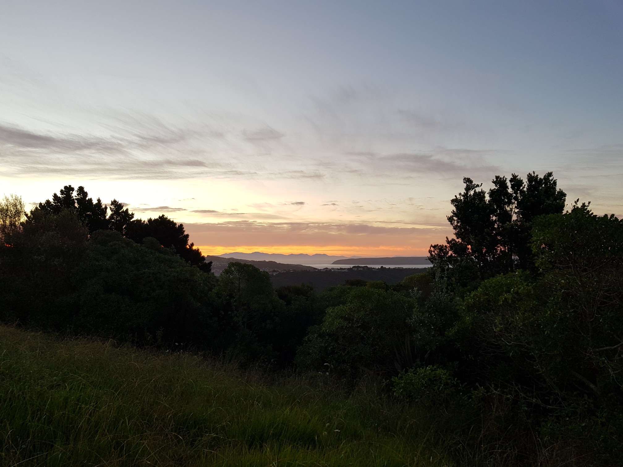
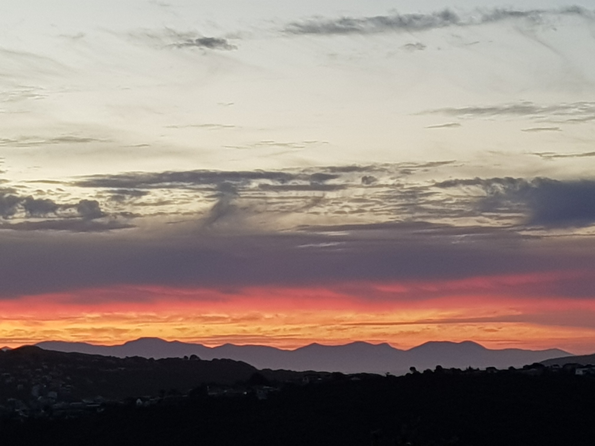
I went to the shops and noticed that the tide was out, so I walked along the beach on the way home. Plus a sunset from a few nights ago.
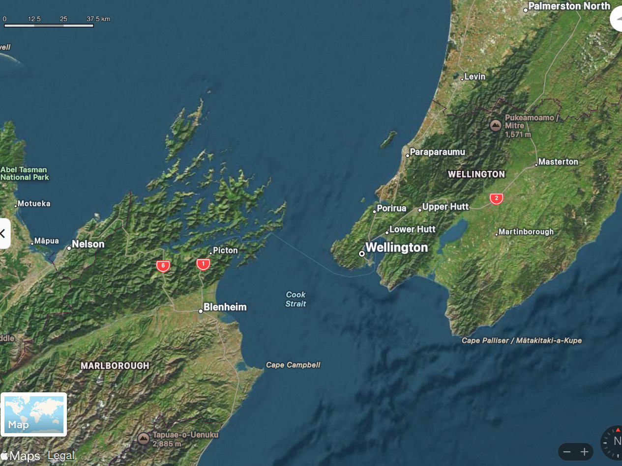
NZ’s two main islands are somewhat perfunctorily named the “North” and “South” Islands; but if you’re near the bottom of the North Island (like myself) then the upper-most parts of the South Island are actually to the west, and only a few tens of kilometres away (the shortest distance between the islands is just 22km). We moved house a few years ago, but it was only a few months back that I realised how easily I could see the South Island from this area (it’s not visible from my house; but it turns out that if I walk up the hill a short way, it’s easy). I only realised because I was walking at sunset one evening, and it was absolutely unmissable against the sun-lit clouds…
As a tangent, Cook Strait – that small stretch of water between the two islands – is fun to read about. It has the Pacific Ocean on one side and the Tasman Sea on the other side (the boundary between the two continental plates cuts through NZ just south of the strait); and it turns out that when it’s high tide on one side of the strait, it’s low tide on the other! The tidal flows are consequently severe; the “Roaring Forties” winds similarly whip through the gap; and underneath it all is a seismically active seabed which varies in depth by hundreds of metres across a multi-branched canyon system (average depth is more than 100m, but nearer 400m in parts – and with the nearby Hikurangi Trough then dropping to 2,700m). It’s a crazy little hotbed of activity.
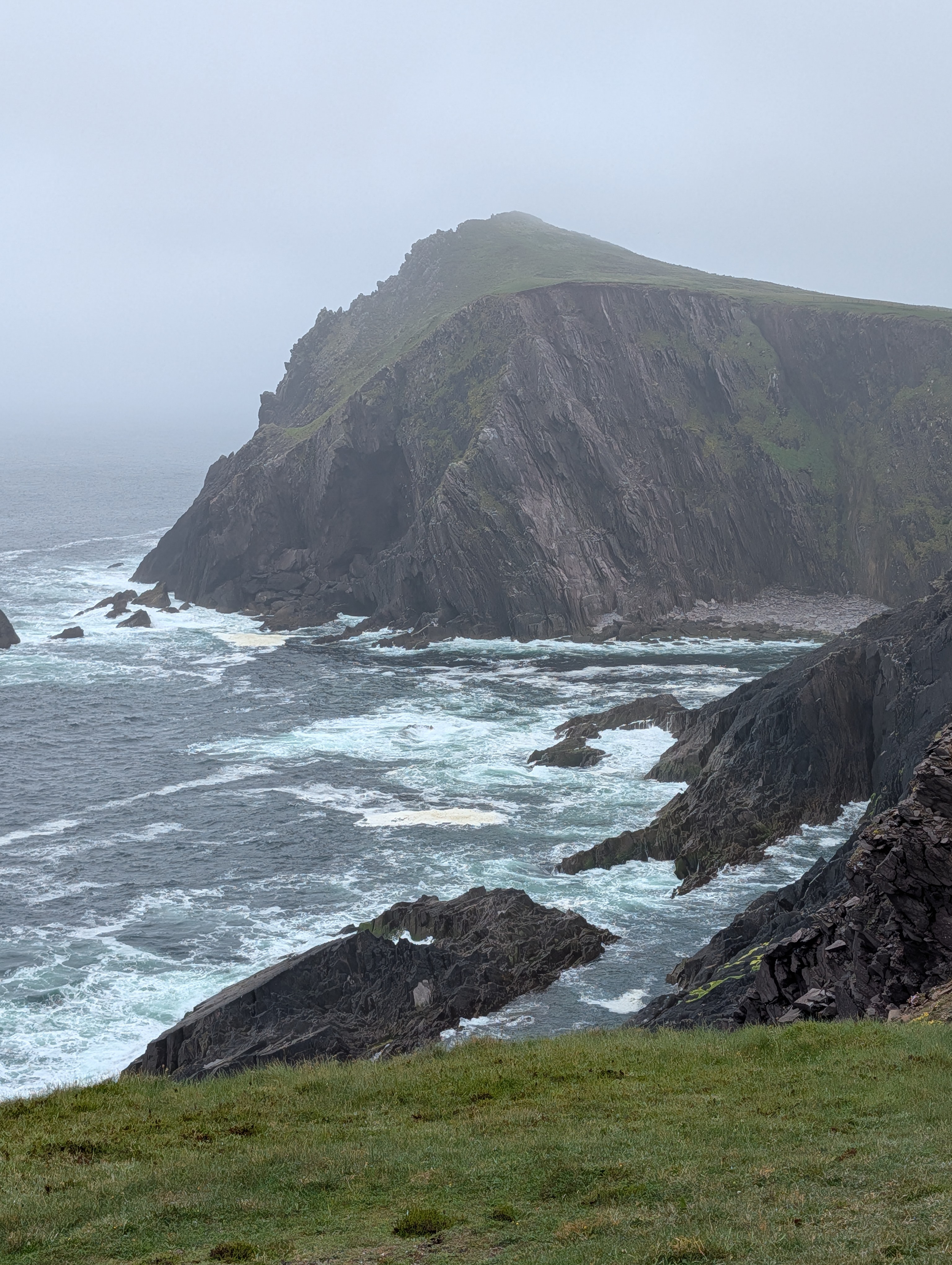
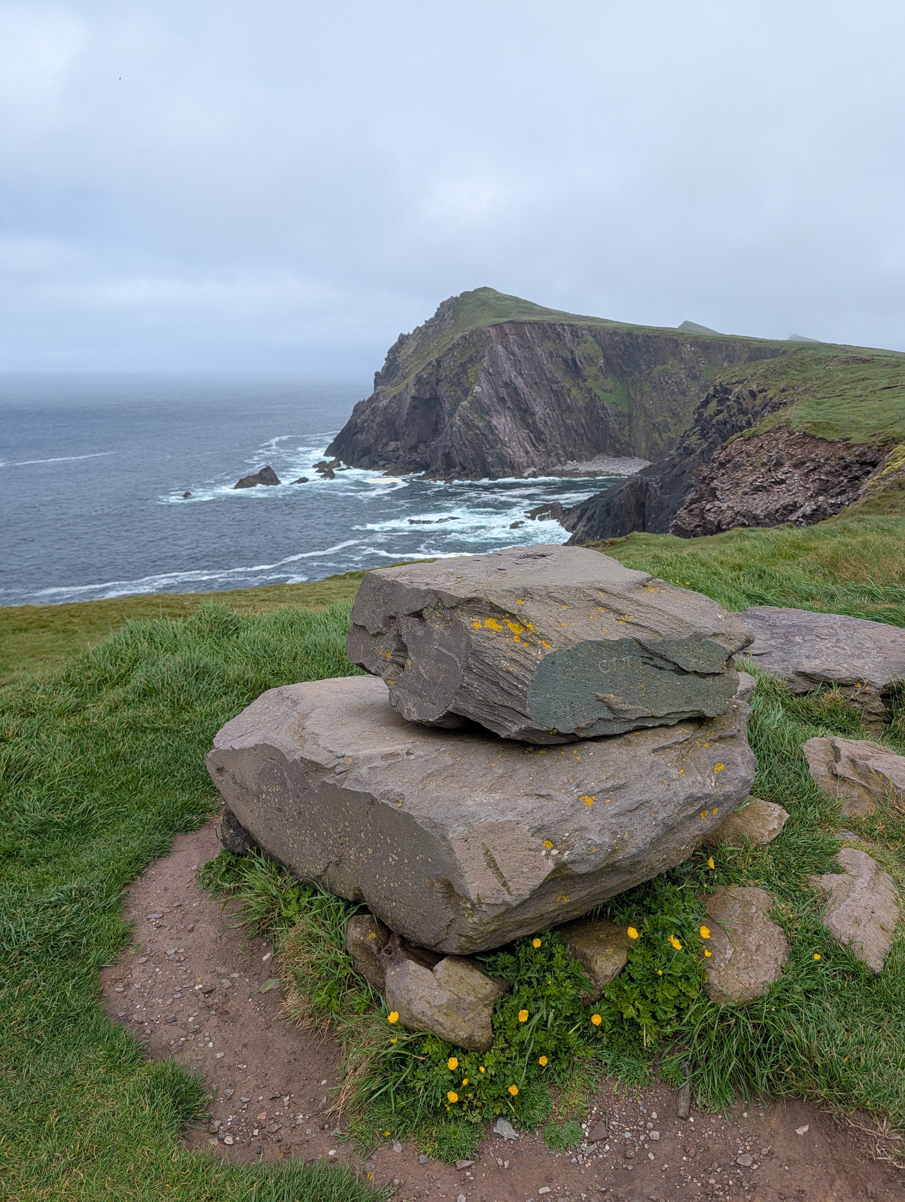
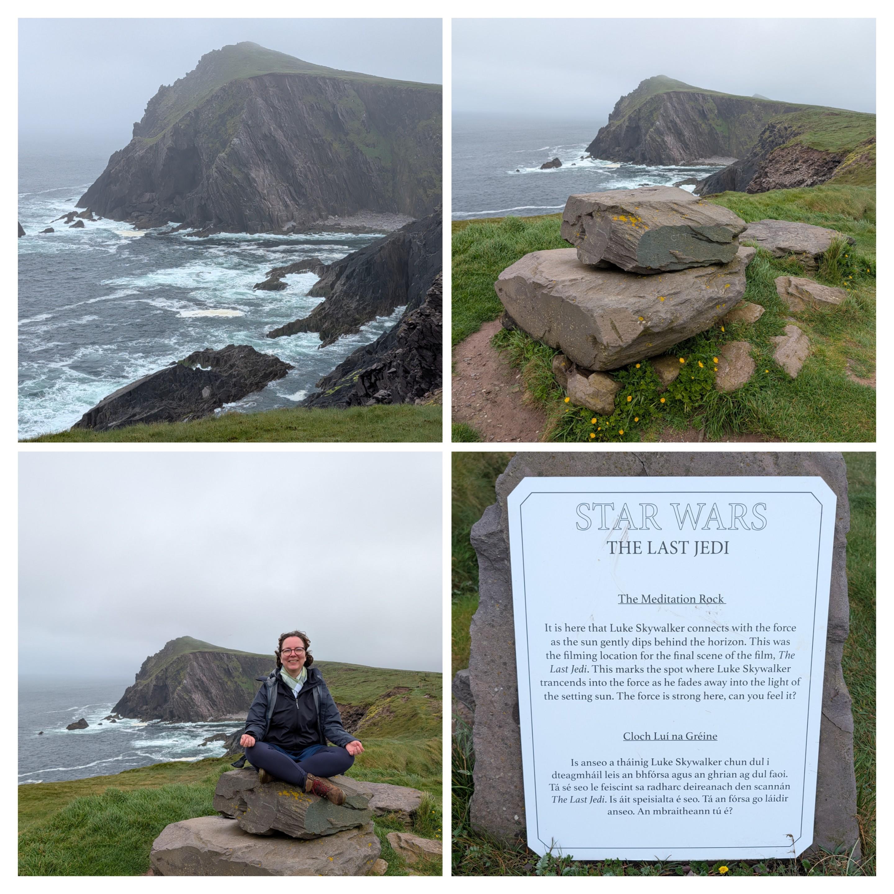
Anyone care to guess where in our Ireland trip we are right now?
A better clue:
weather got better after i sat on the stone for a bit
All that can make for quite an unpleasant crossing!!
Donegal? Looks bleak
Nope. The weather meditation is significant ![]()
![]()
Yeah, there are definitely good crossings and bad crossings!
Some crazy people swim it. It’s considered one of the most challenging swims in the world, but pretty much every year there’s at least one person who does it.
an acquaintance, who served on a destroyer escort in the north atlantic in WW2, and post war in the merchant marine, told me the only time he’d ever been sea sick was on a ferry crossing from one NZ island to the other.
Looks nice by sunset, too. Let’s not talk about the morning with the 1:48am tornado warning wake up call.
Today at Muckross House I felt like we had entered a game of Obsession.
The Irish weather has also fully caught up with us: alternating sun, wind and rain with a frequency of about 5 minutes ![]()
“We need rain, lots of rain!”
A few pictures from our trip to Ireland.
The route was:
We didn’t plan ahead or prebook anything but our accommodation and it worked out quite well.
This was our second big roadtrip since before the pandemic. The other was Sweden but this one worked out much better.
I think we finally got back into our travel mindset.
I don’t have pictures, but I’m going to be glued to the news tonight to see some – the sea is not being kind to Wellington right now (I’m too far away to know), and apparently 11m waves have been recorded (with higher waves being expected) in the harbour.
Edit: Someone has corrected that to at the harbour heads, rather than inside the main harbour (which is a relief, as that sounded terrifying). Still bad for some folks (who have hopefully all followed the evacuation advice), but there are not as many populated areas near the heads.
(For context, Wellington’s harbour is a natural feature of the region, and about 10 kilometres in diameter.)
Edit 2: I saw some footage, and I think for most in the region this might just be “a bad day for a swim” rather than anything worse :). Glad I’m not out in that wind, though – the average wind speed in some areas is close to 90km/h at present.