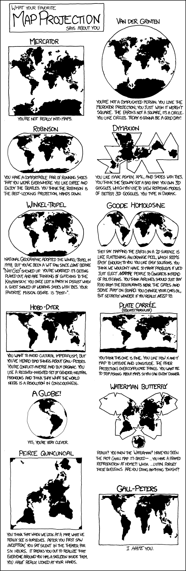
Let me just bring @Benkyo’s image from XKCD over here without uploading it again:
For a map at global scale, I’m usually trying to show which places do or don’t have some characteristic and therefore I look for an equal-area – usually Mollweide for simplicity. (I’m not really trying to say “the UK is north-west of France” on a map like that.)
Is anyone aware of a commonly-accepted population-distorted projection, so that equal populations map to equal area? Or GDP?